

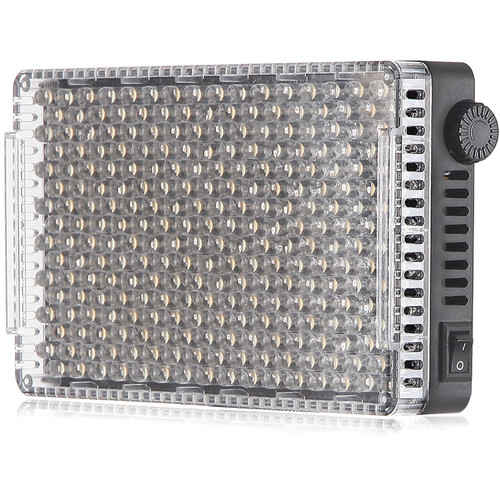
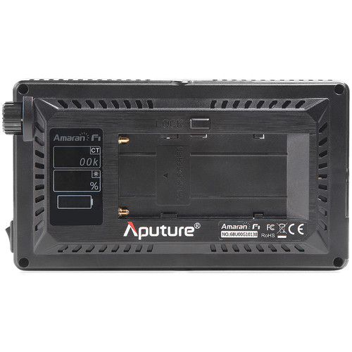



Aputure Amaran AL-F7 On-Camera Variable Color LED Light
- 256 LEDs with 45° Beam Angle
- 3200 to 9500K Output
- 1500 Lux Brightness at 3.3′
- 1 to 100% Dimming
- Single Color Temperature/Dimming Knob
- 15W Maximum Power Draw
- Accepts L-Series Batteries
- LCD Info Screen
- 1/4″-20 Threaded Mounting Hole
- Kindly Note: Prices and Stock Status are Subject to Change without Prior Notice
- Bank Financing attracts an additional percentage
- NB: Warranty registration is the customer's responsibility
- Disclaimer. We can not guarantee that the product specs information on this page is 100% correct.
Aputure AL-F7 Overview
The Aputure Amaran AL-F7 On-Camera Variable Color LED Light is an on-camera LED light that utilizes 256 LEDs with a CRI of 95+ to deliver variable color illumination with high color accuracy. This fixture features variable color temperature output from 3200 to 9500K. The fixture’s 45° beam angle produces a brightness of 1500 lux at 3.3′ when set to 5500K.
A stepless dimming dial is provided on the back of the unit for adjusting light output from 1 to 100%. Color temperature and brightness are also controlled by a single stepless rotating knob. The built-in LCD screen provides information on the remaining battery charge, color temperature, and brightness. Two 1/4″-20 threaded mounting holes, one on top and one at the bottom of the fixture, provide for a variety of mounting possibilities. Buy the Aputure Amaran AL-F7 On-Camera Variable Color LED Light Best Price Online from CELLULAR KENYA,Nairobi
Related products
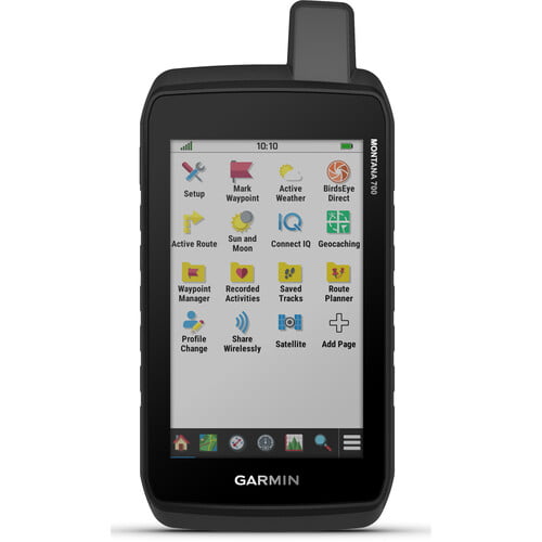
Garmin Montana 700
- Expect big things. A large touchscreen puts them all at your fingertips.
- Routable topographic maps? Check. Now you’re free to take it off-road or on.
- Built like a tank. Meets MIL-STD 810 for thermal, shock, water and vibration.
- Get the clear perspective of BirdsEye Satellite Imagery right to your device.
- Go far with no fear. ABC sensors and multiple GNSS networks have your back.
- Power your adventures with 18+ hours of lithium-ion battery life in GPS mode.
- This durable, water-resistant handheld is tested to U.S. military standards and features a glove-friendly 5” touchscreen that’s 50% larger than previous Montana models.
- To navigate your adventures, use preloaded topographical maps for the U.S. and Canada. View terrain contours, elevations, coastlines, rivers, landmarks and more.
- Optional display of federal public land boundaries on topographical maps helps you know that you’re venturing where you’re supposed to be.
- Use direct-to-device downloads of BirdsEye Satellite Imagery (no annual subscription required) to see photo-realistic views and create waypoints based on landmarks.
- Add a subscription to Outdoor Maps+, and get ongoing access to a wide variety of premium mapping content and regular updates sent right to your Garmin device via Wi-Fi® technology.
- With 16 GB of onboard memory and a microSD™ card slot for expandable storage, you can download even more maps such as City Navigator® for your drive or BlueChart® g3 for the water.
- Navigate your next trail with ABC sensors, including an altimeter for elevation data, barometer to monitor weather and 3-axis electronic compass.
- Use cellular connectivity to access up-to-date Active Weather forecasts through the Garmin Connect™ app.
- For hunters and trainers, this Montana syncs with compatible Astro® or Alpha® series handhelds (sold separately) to help track sporting dogs in the field.
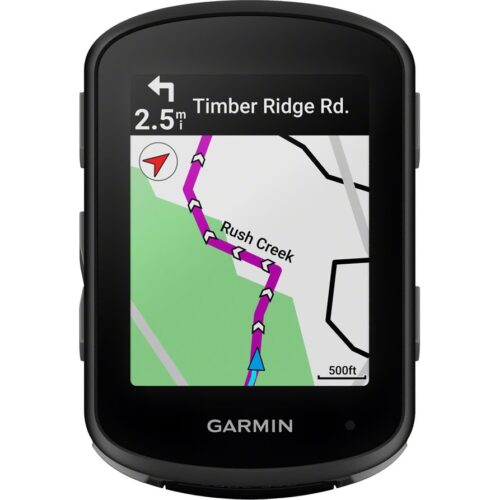
GARMIN Edge 540 Solar
Key Features;
- Extends battery life with solar charging.
- Touchscreen interface
- Navigation, mapping, incident detection, and group tracking.
- Distance, speed, pace, elevation, heart rate, power, etc.
- Up to 26 hours in standard mode, extended with solar charging.
- Customizable display
- Works with various sensors and accessories.
- Improved map detail compared to the Edge 530.
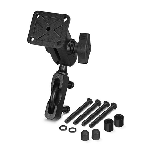
Garmin Zumo Xt-Mt
- Robust and weatherproof all-terrain motorcycle navigation system (IPX7 standard) with ultra-bright 5.5-inch HD touch display
- Use in portrait and landscape format as well as comfortably usable with gloves
- Street navigation maps for Europe including updates
- Pre-installed topographic maps for the site navigation in Europe
- BirdsEye satellite images via download included
- Garmin Adventurous Routing, round trip, route planning and TracBack function
- Live weather, live traffic and more via Garmin Drive app
- TripAdvisor, Foursquare, iOverlander and Garmin Motorrad POIs
- Bluetooth hands-free function, music control and integrated MP3 player
- Built-in track recorder with compass and elevation profile
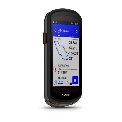
Garmin Edge 1040
Key features:
- Advanced GPS bike computer combines superior navigation, planning and performance tracking, cycling awareness and smart connectivity
- Find your way in the most challenging environments with multi-band GNSS technology that provides enhanced positioning accuracy
- Simplified setup and a streamlined interface make it quick and easy to access the information, courses and tools you need and even adjust data fields right from the Edge device or from your paired smartphone
- Classify your strengths as a cyclist, and compare your cycling ability to the demands of a specific course when paired with your compatible sensors, so you can focus your training and improvement in the right areas
- Manage your efforts with the power guide feature, which recommends power targets throughout a course, when paired with your compatible sensors
- Get stamina feature insights while you ride, when paired with your compatible sensors, so you can keep an eye on how much longer you can really push it
- Stay on top of your training program with prompts to complete missed workouts
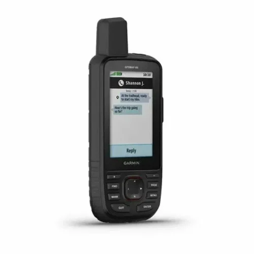
Garmin GPSMAP 66i
Key features:
- Large 3 inch Sunlight-readable color display for easy viewing
- Trigger an interactive SOS to the geos 24/7 search and rescue monitoring center, two-way messaging via the 100% Global Iridium satellite network (satellite subscription required)
- Preloaded Garmin TOPO mapping with direct-to-device Birdseye satellite imagery downloads (no annual subscription), includes multiple global navigation satellite systems (GNSS) support and navigation sensors
- Cellular connectivity lets you access active weather forecasts and geocaching live
- Compatible with the Garmin explore website and app to help you manage waypoints, routes, activities and collections, use tracks and review trip data from the field
- Internal, rechargeable lithium battery provides up to 35 hours of battery life in 10-minute tracking mode and 1-minute tracking mode (display off), 200 hours in Expedition mode with 30-minute tracking
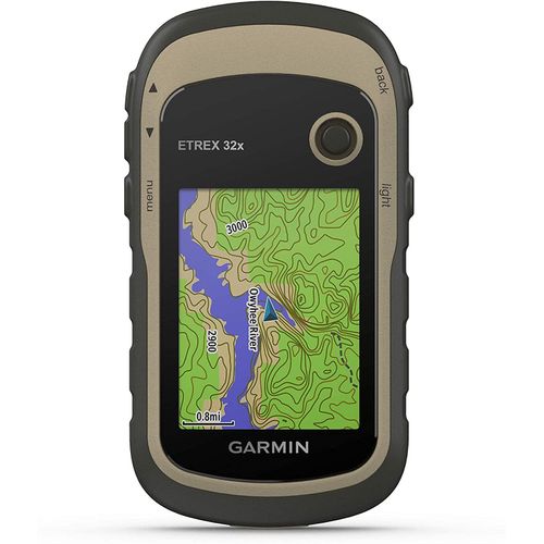
Garmin eTrex 32x GPS Navigator
Key features:
- 2.2” sunlight-readable color display with 240 x 320 display pixels for improved readability
- Preloaded with TopoActive maps with routable roads and trails for cycling and hiking
- Support for GPS and GLONASS satellite systems allows for tracking in more challenging environments than GPS alone
- 8 GB of internal memory for map downloads plus a microSD™ card slot
- eTrex 32x adds a 3-axis compass and barometric altimeter
- Battery life: up to 25 hours in GPS mode with 2 AA batteries

Reviews
There are no reviews yet.