


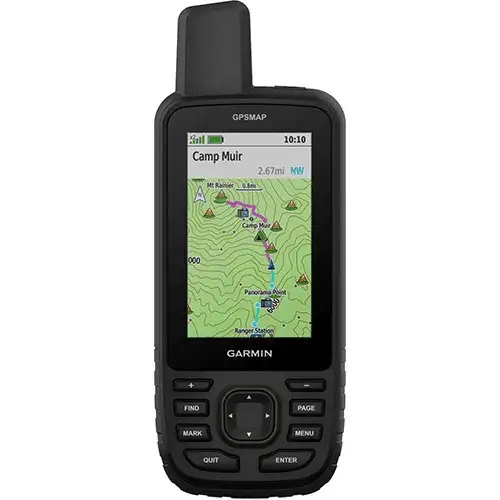
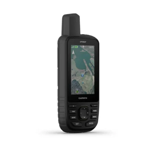
Garmin GPSMAP 66i
Original price was: KSh 72,999.00.KSh 71,000.00Current price is: KSh 71,000.00. + VAT
Key features:
- Large 3 inch Sunlight-readable color display for easy viewing
- Trigger an interactive SOS to the geos 24/7 search and rescue monitoring center, two-way messaging via the 100% Global Iridium satellite network (satellite subscription required)
- Preloaded Garmin TOPO mapping with direct-to-device Birdseye satellite imagery downloads (no annual subscription), includes multiple global navigation satellite systems (GNSS) support and navigation sensors
- Cellular connectivity lets you access active weather forecasts and geocaching live
- Compatible with the Garmin explore website and app to help you manage waypoints, routes, activities and collections, use tracks and review trip data from the field
- Internal, rechargeable lithium battery provides up to 35 hours of battery life in 10-minute tracking mode and 1-minute tracking mode (display off), 200 hours in Expedition mode with 30-minute tracking
- Kindly Note: Prices and Stock Status are Subject to Change without Prior Notice
- Bank Financing attracts an additional percentage
- NB: Warranty registration is the customer's responsibility
- Disclaimer. We can not guarantee that the product specs information on this page is 100% correct.
Features and Benefits
|
|
|
|
|---|---|---|
Satellite CommunicationStaying in touch is vital, even on less challenging trips. Using inReach technology (subscription required), this handheld lets you trigger an SOS to the GEOS 24/7 emergency response team for interactive support in an emergency. It also enables two-way messaging and LiveTrack location sharing via the 100% global Iridium satellite network, so you can stay in contact with loved ones, teammates, headquarters and more. |
Weather AnywhereWireless Cellular connectivity lets you access Active Weather for up-to-date forecasts, including predictive maps for temperature, wind, precipitation and clouds — right on the handheld when connected to Garmin Connect Mobile. |
Pair with Your Mobile DeviceThe free Garmin Explore mobile app lets you plan, review and sync data, including waypoints, routes, activities and collections. Review completed activities while still in the field, even when you’re off the grid. The app also lets you sync your GPSMAP 66i with your compatible mobile device so you can access unlimited maps, aerial imagery and U.S. NOAA charts. You can even use all of the inReach features on your paired mobile device. For easier messaging, you can access your phone’s contact list from the Garmin Explore app to connect with fewer keystrokes. Plan for future trips and review previous activities from the Garmin Explore website. |


Related products
Garmin 67
-
3-inch sunlight-readable color display
-
Multi-band GNSS (GPS, GLONASS, Galileo, QZSS, IRNSS)
-
Preloaded TopoActive maps
-
BirdsEye Satellite Imagery (direct download)
-
Digital 3-axis compass
-
Barometric altimeter
-
Extended battery life (up to 180 hours in standard mode, 840 hours in expedition mode)
-
Wireless connectivity (Wi-Fi®, Bluetooth®, ANT+®)
-
Rugged, water-resistant design (IPX7)
-
Garmin Explore app compatibility

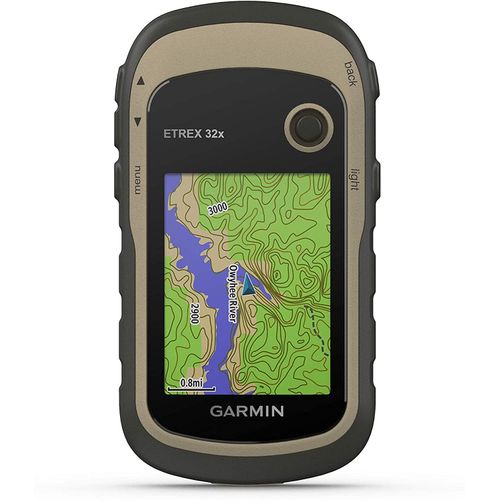
Garmin eTrex 32x GPS Navigator
- 2.2” sunlight-readable color display with 240 x 320 display pixels for improved readability
- Preloaded with TopoActive maps with routable roads and trails for cycling and hiking
- Support for GPS and GLONASS satellite systems allows for tracking in more challenging environments than GPS alone
- 8 GB of internal memory for map downloads plus a microSD™ card slot
- eTrex 32x adds a 3-axis compass and barometric altimeter
- Battery life: up to 25 hours in GPS mode with 2 AA batteries

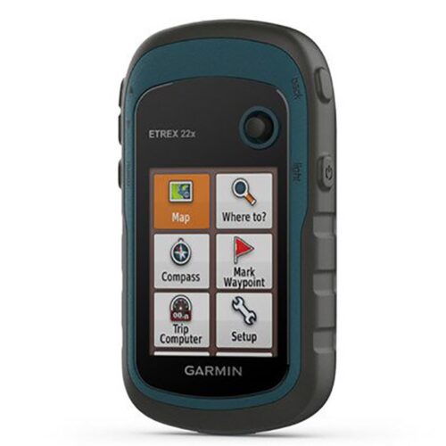
Garmin eTrex 22x
- 2.2” sunlight-readable color display with 240 x 320 display pixels for improved readability
- Preloaded with TopoActive maps with routable roads and trails for cycling and hiking
- Support for GPS and GLONASS satellite systems allows for tracking in more challenging environments than GPS alone
- 8 GB of internal memory for map downloads plus a microSD™ card slot
- eTrex 32x adds a 3-axis compass and barometric altimeter
- Battery life: up to 25 hours in GPS mode with 2 AA batteries

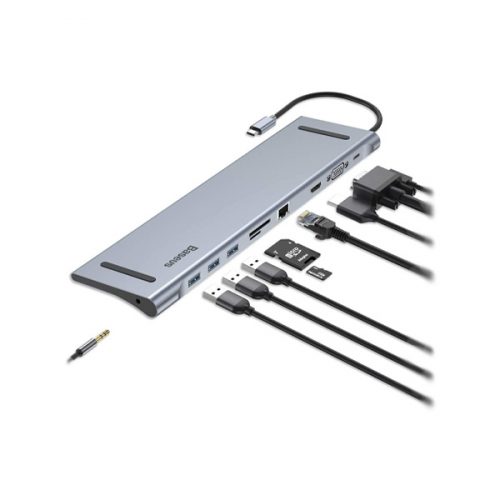
Baseus 10 In 1 Type C Multi Port USB C Hub Adapter
- Standard:USB 3.0
- Plug Standard:None
- Interface Type:USB Type-C
- Ports:10
- Funtion: HDMI/Card Reader/RJ45
- Length: 48.8cm
- Material:Aluminum Alloy
- Feature 1:USB 3.0 HUB For HUAWEI Mate 10/Mate 10 Pro
- Feature 2:USB Type-C HUB,Type C HUB,Laptop PC USB C HUB
- Feature 3:USB C HUB Adapter, USB C HUB Connector
- Feature 4:USB-C to HDMI/VGA/Card reader/RJ45 adapter
- Feature 5:Laptop accessories,USB-C docking station
- Feature 6:10 in 1 Macbook Phones Multi-Function Docking Station
- Feature 7:OTG Hub,OTG Adapter
- Note:Does not support XP 64bit,Linux
- Output:USB 3.0*3,HDMI ,RJ45 ,VGA,SD TF Card Reader