
Garmin Montana 760i GPS Navigator
KSh 85,800.00 + VAT
-
Key Features
- Global Connectivity with Subscription
- 24/7 Interactive SOS
- 5″ Touchscreen
- 8MP Camera
- MIL-STD 810 Water & Impact Resistant
- Preloaded Worldwide Topo Maps
- Free Downloadable Satellite Imagery
- Outdoor Maps+ (Subscription)
- GPS & Galileo Satellite Navigation
- Altimeter, Barometer, Compass
- Kindly Note: Prices and Stock Status are Subject to Change without Prior Notice
- Bank Financing attracts an additional percentage
- NB: Warranty registration is the customer's responsibility
- Disclaimer. We can not guarantee that the product specs information on this page is 100% correct.
Garmin Montana 760i GPS Navigator in Kenya.
Garmin Montana 760i GPS Navigator price in Kenya is at Ksh85,800.
Combining three indispensable tools—a multi-service navigator, a satellite communicator, and a camera to capture the adventure—the Garmin Montana 760i GPS Navigator with In-Reach & 8MP Camera can help you find your way around remote areas and stay in touch with the world, even where there’s no cell service. With a satellite network subscription, you’ll be able to communicate with other In-Reach users in the field and with Garmin Response, a 24/7-staffed professional emergency response coordination center. You can also get In-Reach weather and a live tracker that folks back home can use to follow your progress. Loaded with maps and apps, the Montana 710i will be your trusted companion in the backcountry.
Buy Garmin Montana 760i GPS Navigator Best Price Online from CELLULAR KENYA,Nairobi.
Related products
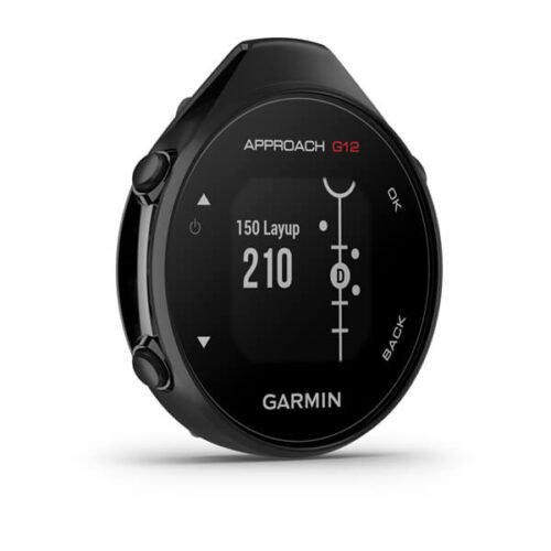
Garmin Approach G12
- Compact clip-on GPS rangefinder attaches to pocket, belt or bag
- Preloaded with over 42,000 golf courses worldwide (no subscription needed)
- Green View shows true green shape from your current position
- Drag-and-drop pin placement for precise manual green distances
- Big Numbers mode displays large, easy-to-read yardages
- Digital scorecard tracks scores on-device or via Garmin Golf app
- Automatic course detection when paired with the app
- Sunlight-readable monochrome display (176 × 176 pixels)
- Rechargeable battery lasts up to 30 hours in GPS mode
- IPX7 waterproof rating withstands rain & splashes
- Lightweight design (25.1g) for all-day comfort
- Bluetooth connectivity to Garmin Golf app for stats & tracking
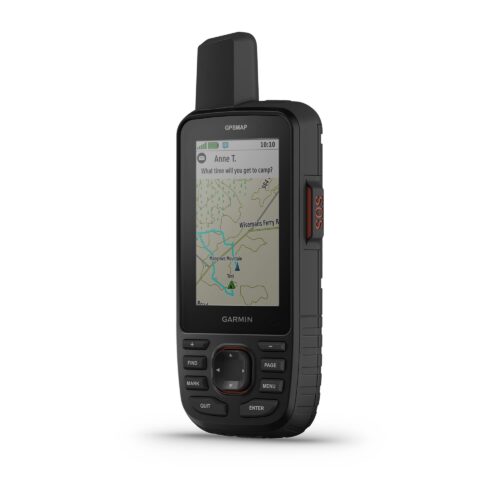
Garmin 67
Key Features
-
3-inch sunlight-readable color display
-
Multi-band GNSS (GPS, GLONASS, Galileo, QZSS, IRNSS)
-
Preloaded TopoActive maps
-
BirdsEye Satellite Imagery (direct download)
-
Digital 3-axis compass
-
Barometric altimeter
-
Extended battery life (up to 180 hours in standard mode, 840 hours in expedition mode)
-
Wireless connectivity (Wi-Fi®, Bluetooth®, ANT+®)
-
Rugged, water-resistant design (IPX7)
-
Garmin Explore app compatibility

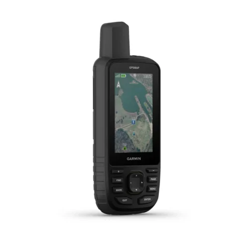
Garmin Montana 710i
Key Features
-
5-inch sunlight-readable glove-friendly touchscreen
-
Multi-GNSS support (GPS, GLONASS, Galileo)
-
TOPO mapping and City Navigator routing
-
Two-way messaging and interactive SOS with inReach technology
-
Preloaded TopoActive maps
-
BirdsEye Satellite Imagery (direct download)
-
Built-in 3-axis compass and barometric altimeter
-
8-megapixel camera with geotagging
-
Wireless connectivity (Wi-Fi, Bluetooth, ANT
-
Rugged, water-resistant design (IPX7)
-
Powered by lithium-ion battery pack or AA batteries
-
Compatible with Garmin Explore app
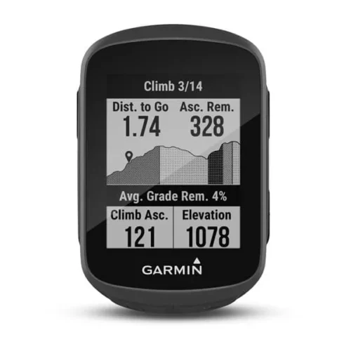
Garmin Edge 130 Plus
key features:
- Extremely lightweight and compact GPS bike computer for road and MTB with easy to read 1.8″ display even in direct sunlight or low light
- Performance evaluation and easy training plan synchronization
- Navigation with turn-by-turn instructions and route display
- ClimbPro for optimal planning of upcoming climbs
- MTB Dynamics with grit –, flow and jump analysis
- With GPS, GLONASS and Galileo satellites and an altimeter, you’ll know how far, fast, hard and high you’ve ridden on the longest climbs or on your way through the city
- Includes navigation with turn prompts and even shows you how to get back to start; download courses from the Course Creator feature in Garmin Connect™ online community, and race in real time against Strava Live Segments
- Compatible with Varia™ cycling awareness accessories, including rear-view radar and smart bike lights
- Connected features include smart notifications, weather and more; LiveTrack and Assistance features make it easy to share your location
- Battery life: up to 12 hours
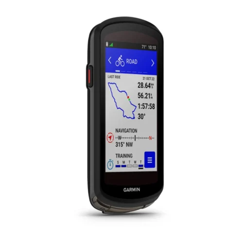
Garmin Edge 1040
Key features:
- Advanced GPS bike computer combines superior navigation, planning and performance tracking, cycling awareness and smart connectivity
- Find your way in the most challenging environments with multi-band GNSS technology that provides enhanced positioning accuracy
- Simplified setup and a streamlined interface make it quick and easy to access the information, courses and tools you need and even adjust data fields right from the Edge device or from your paired smartphone
- Classify your strengths as a cyclist, and compare your cycling ability to the demands of a specific course when paired with your compatible sensors, so you can focus your training and improvement in the right areas
- Manage your efforts with the power guide feature, which recommends power targets throughout a course, when paired with your compatible sensors
- Get stamina feature insights while you ride, when paired with your compatible sensors, so you can keep an eye on how much longer you can really push it
- Stay on top of your training program with prompts to complete missed workouts