

Garmin Enduro 3
KSh 105,950.00 + VAT

PS5 Slim 30th Anniversary Edition
KSh 102,000.00 + VAT
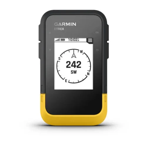
Garmin eTrex Solar
KSh 33,000.00 + VAT
- Kindly Note: Prices and Stock Status are Subject to Change without Prior Notice
- Bank Financing attracts an additional percentage
- NB: Warranty registration is the customer's responsibility
- Disclaimer. We can not guarantee that the product specs information on this page is 100% correct.
Description
Garmin eTrex Solar Price & features in kenya
Garmin eTrex Solar Price in kenya is at ksh 33000
- Bright sunlight is no problem with the high-resolution 2.2” screen.
- Head out for longer trips with unlimited battery life when used in sunny 75,000 lux conditions.
- Want next-level positional accuracy? You got it with multi-band GPS.
- Plan trips and more when you pair with the Garmin Explore™ smart-device app.
- Keep your bearings with the digital compass so you’re always on course.
- Don’t worry about the weather. It’s water-resistant and rated to IPX7.
- Get unlimited battery life when used in sunny 75,000 lux conditions or up to 200 hours with no solar charging.
- Multi-band GPS gives you access to multiple frequencies sent by navigation satellites to improve positional accuracy.
- Get automatic cache updates from Geocaching Live, including descriptions, logs and hints. When connected to the Garmin Explore app, each find will upload to your Geocaching.com profile
- Follow your bearing on the digital compass, which provides an accurate heading even when stationary.
- When connected to the Garmin Explore app, you can get real-time forecast information, so you’re aware of the changing conditions.
- Connect with the Garmin Explore app for wireless software updates, cloud storage, trip planning, smart notifications and additional mapping
Buy The Garmin eTrex Solar Price Online from CELLULAR KENYA,Nairobi
Shipping & Delivery
Related products

Garmin Montana 710i
Key Features
-
5-inch sunlight-readable glove-friendly touchscreen
-
Multi-GNSS support (GPS, GLONASS, Galileo)
-
TOPO mapping and City Navigator routing
-
Two-way messaging and interactive SOS with inReach technology
-
Preloaded TopoActive maps
-
BirdsEye Satellite Imagery (direct download)
-
Built-in 3-axis compass and barometric altimeter
-
8-megapixel camera with geotagging
-
Wireless connectivity (Wi-Fi, Bluetooth, ANT
-
Rugged, water-resistant design (IPX7)
-
Powered by lithium-ion battery pack or AA batteries
-
Compatible with Garmin Explore app
GARMIN Edge 540 Solar
Key Features;
- Extends battery life with solar charging.
- Touchscreen interface
- Navigation, mapping, incident detection, and group tracking.
- Distance, speed, pace, elevation, heart rate, power, etc.
- Up to 26 hours in standard mode, extended with solar charging.
- Customizable display
- Works with various sensors and accessories.
- Improved map detail compared to the Edge 530.
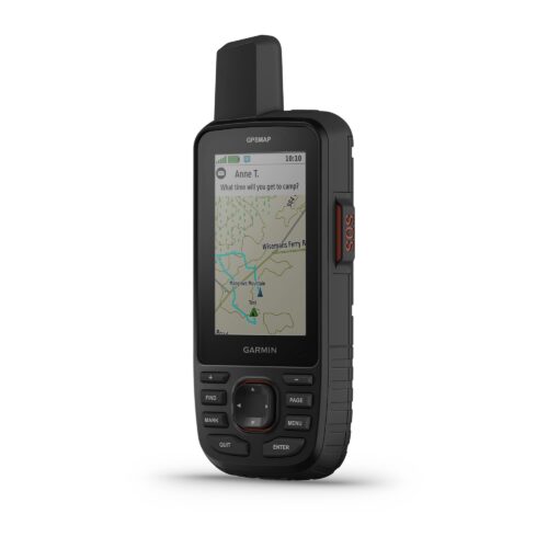
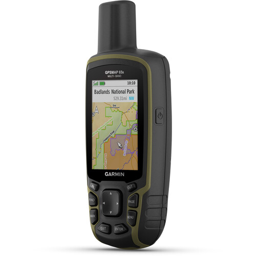
Garmin GPSMAP 66i
Key features:
- Large 3 inch Sunlight-readable color display for easy viewing
- Trigger an interactive SOS to the geos 24/7 search and rescue monitoring center, two-way messaging via the 100% Global Iridium satellite network (satellite subscription required)
- Preloaded Garmin TOPO mapping with direct-to-device Birdseye satellite imagery downloads (no annual subscription), includes multiple global navigation satellite systems (GNSS) support and navigation sensors
- Cellular connectivity lets you access active weather forecasts and geocaching live
- Compatible with the Garmin explore website and app to help you manage waypoints, routes, activities and collections, use tracks and review trip data from the field
- Internal, rechargeable lithium battery provides up to 35 hours of battery life in 10-minute tracking mode and 1-minute tracking mode (display off), 200 hours in Expedition mode with 30-minute tracking
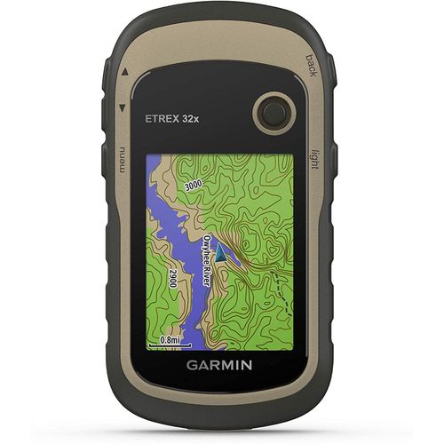
Garmin eTrex 32x GPS Navigator
Key features:
- 2.2” sunlight-readable color display with 240 x 320 display pixels for improved readability
- Preloaded with TopoActive maps with routable roads and trails for cycling and hiking
- Support for GPS and GLONASS satellite systems allows for tracking in more challenging environments than GPS alone
- 8 GB of internal memory for map downloads plus a microSD™ card slot
- eTrex 32x adds a 3-axis compass and barometric altimeter
- Battery life: up to 25 hours in GPS mode with 2 AA batteries
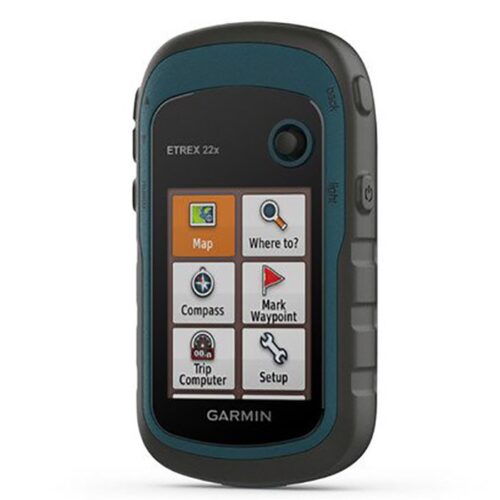
Garmin eTrex 22x
Key features:
- 2.2” sunlight-readable color display with 240 x 320 display pixels for improved readability
- Preloaded with TopoActive maps with routable roads and trails for cycling and hiking
- Support for GPS and GLONASS satellite systems allows for tracking in more challenging environments than GPS alone
- 8 GB of internal memory for map downloads plus a microSD™ card slot
- eTrex 32x adds a 3-axis compass and barometric altimeter
- Battery life: up to 25 hours in GPS mode with 2 AA batteries

Garmin GPSMAP 65s Handheld Navigator with Altimeter, Barometer, & Compass
Key Features
- Multi-Band GNSS for Optimal Accuracy
- US & Canada Routable Topo Maps
- 2.6" Sunlight-Readable Color Display
- Barometer, Altimeter, 3-Axis Compass
- Receive Alerts from Your Phone
- Shows Public Land Boundaries
- Plan with Garmin Explore Map
- microSD Card Slot for Adding Maps
- Auto Cache Updates from Geocaching Live
- Runs on 2 x AA Batteries