
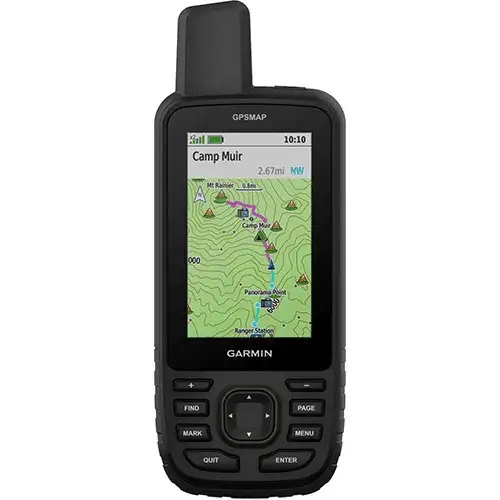
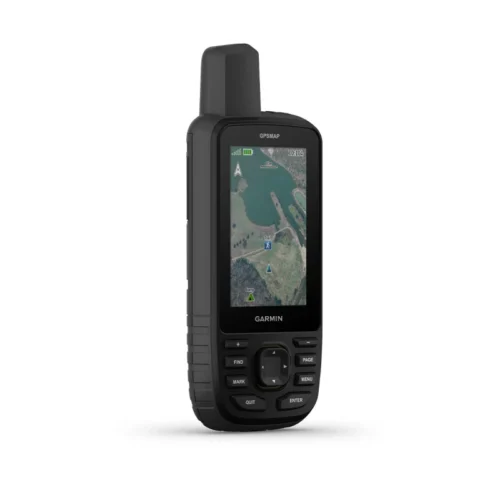
Garmin Gpsmap 67i
Original price was: KSh 88,000.00.KSh 73,000.00Current price is: KSh 73,000.00. + VAT
- Kindly Note: Prices and Stock Status are Subject to Change without Prior Notice
- Bank Financing attracts an additional percentage
- NB: Warranty registration is the customer's responsibility
- Disclaimer. We can not guarantee that the product specs information on this page is 100% correct.
Garmin Gpsmap 67i In Kenya
Garmin Gpsmap 67i Price in Kenya is Ksh 73000.GO EXPLORE THE OUTDOORS – AND STAY CONNECTED TO HOME
Make more time for adventure with this premium, rugged handheld GPS and satellite communicator. Get inReach® technology that enables two-way messaging, interactive SOS alerts and location sharing1 plus mapping to keep you on course.Buy the Garmin Gpsmap 67i Best Price Online from CELLULAR KENYA,Nairobi
-Travel longer with up to 165 hours of battery life in tracking mode and up to 425 hours in expedition mode.
-Two-way messaging lets you share the moment with the ones who matter.
-Let your loved ones follow your adventure with location tracking.
-Have an emergency? Trigger an interactive SOS alert anytime, globally.
-Track your position in challenging conditions with multi-band technology and expanded GNSS support.
N.B. InReach subscription is required for Satellite messaging & SOS function, please see our FAQ’s tab.
Related products
Garmin 67
-
3-inch sunlight-readable color display
-
Multi-band GNSS (GPS, GLONASS, Galileo, QZSS, IRNSS)
-
Preloaded TopoActive maps
-
BirdsEye Satellite Imagery (direct download)
-
Digital 3-axis compass
-
Barometric altimeter
-
Extended battery life (up to 180 hours in standard mode, 840 hours in expedition mode)
-
Wireless connectivity (Wi-Fi®, Bluetooth®, ANT+®)
-
Rugged, water-resistant design (IPX7)
-
Garmin Explore app compatibility

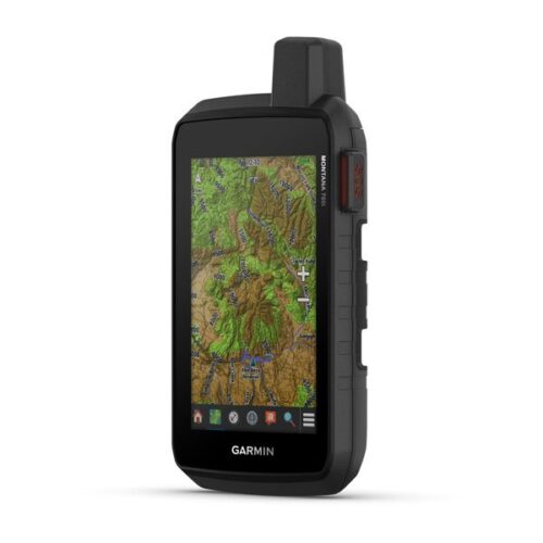
Garmin Montana 710i
-
5-inch sunlight-readable glove-friendly touchscreen
-
Multi-GNSS support (GPS, GLONASS, Galileo)
-
TOPO mapping and City Navigator routing
-
Two-way messaging and interactive SOS with inReach technology
-
Preloaded TopoActive maps
-
BirdsEye Satellite Imagery (direct download)
-
Built-in 3-axis compass and barometric altimeter
-
8-megapixel camera with geotagging
-
Wireless connectivity (Wi-Fi, Bluetooth, ANT
-
Rugged, water-resistant design (IPX7)
-
Powered by lithium-ion battery pack or AA batteries
-
Compatible with Garmin Explore app
GARMIN Edge 530GPS Bundle
- Alerts (triggers alarm when you reach time, distance, HR, calories goals): yes
- Internal memory: 16 GB
- Compatible with Varia™bike radar and lights: yes
- LiveTrack: yes
- Advanced performance and power analysis, including new Time in Zone, FTP tracking, cycling-specific VO2 and recovery and cycling dynamics
- Bike trainer profile for compatible Turbo trainer data display and control
- On-device segment compatibility for dynamic and engaging in-ride competition
- Operating temperature: -20°C to +55°C
- Connected features via a smartphone: yes
- Integration with Shimano Di2 electronic shifting: yes
- Weather alerts: yes
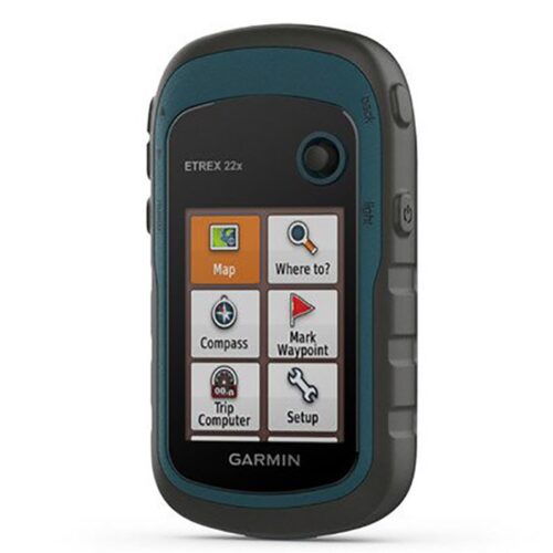
Garmin eTrex 22x
- 2.2” sunlight-readable color display with 240 x 320 display pixels for improved readability
- Preloaded with TopoActive maps with routable roads and trails for cycling and hiking
- Support for GPS and GLONASS satellite systems allows for tracking in more challenging environments than GPS alone
- 8 GB of internal memory for map downloads plus a microSD™ card slot
- eTrex 32x adds a 3-axis compass and barometric altimeter
- Battery life: up to 25 hours in GPS mode with 2 AA batteries

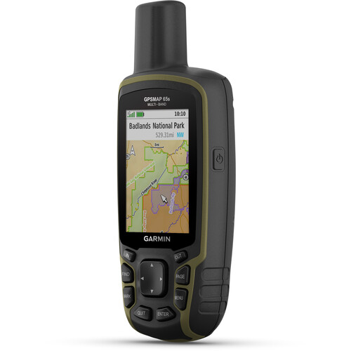
Garmin GPSMAP 65s Handheld Navigator with Altimeter, Barometer, & Compass
- Multi-Band GNSS for Optimal Accuracy
- US & Canada Routable Topo Maps
- 2.6" Sunlight-Readable Color Display
- Barometer, Altimeter, 3-Axis Compass
- Receive Alerts from Your Phone
- Shows Public Land Boundaries
- Plan with Garmin Explore Map
- microSD Card Slot for Adding Maps
- Auto Cache Updates from Geocaching Live
- Runs on 2 x AA Batteries